How To Use Garmin Chartplotters For Navigation? (2023)
Garmin is a well-known name in navigation, and its chartplotters are no exception.
Chartplotters are essential for anyone who spends time on the water, whether you're a fisherman, sailor, or just out for a day on the boat.
Garmin chartplotters are easy to use, intuitive, and packed with features to make your boating experience safe and enjoyable.
This post will provide a step-by-step guide to using Garmin chartplotters to plan routes and set courses.
We'll also explain how to integrate other equipment on board, like radar, engines, and lights, and how to use GPS to show your exact location on a navigational chart.
Let's get started!
Step 1: Choose the Right Chartplotter for Your Needs
Garmin offers a range of chartplotters to suit different needs and budgets. Some of the most popular models include:
- GPSMAP® x3 chartplotters: These gadget are available in a range of sizes and offer a variety of features, including built-in sonar capabilities and the ability to show data from other equipment on board. They use GPS to show your location on a navigational chart and provide real-time updates on your heading and speed.
- ECHOMAP™ Ultra chartplotters: These devices offer advanced features like Ultra High-Definition scanning sonar and the ability to create custom maps on the fly. They are also compatible with the ActiveCaptain app, which allows you to manage your marine experience from your smartphone or tablet.
- ECHOMAP™ UHD2 chartplotters: These chartplotters offer clear, crisp sonar and mapping and are available in 5" and 7" sizes. They also provide Wi-Fi connectivity for easy sharing of information between compatible devices.
Before you choose a chartplotter, consider your specific needs and the type of boating you'll be doing.
For example, if you're a serious angler, you may want a chartplotter with advanced sonar capabilities.
On the other hand, if you're a sailor, you may wish to have a chartplotter that can show data from your wind instruments.
Step 2: Install Your Chartplotter
Once you've chosen the right chartplotter for your needs, it's time to install it on your boat.
Garmin chartplotters are designed to be easy to install, but if you're uncomfortable doing it yourself, having a professional do it for you is always a good idea.
Before installing your device, ensure you have all the necessary components, including the chartplotter itself, a mounting bracket, power cables, and any transducers or sensors you'll need.
You'll also need to decide where to mount your gadget.
Ideally, you'll want it to be within easy reach of the helm and in a location where it won't get in the way.
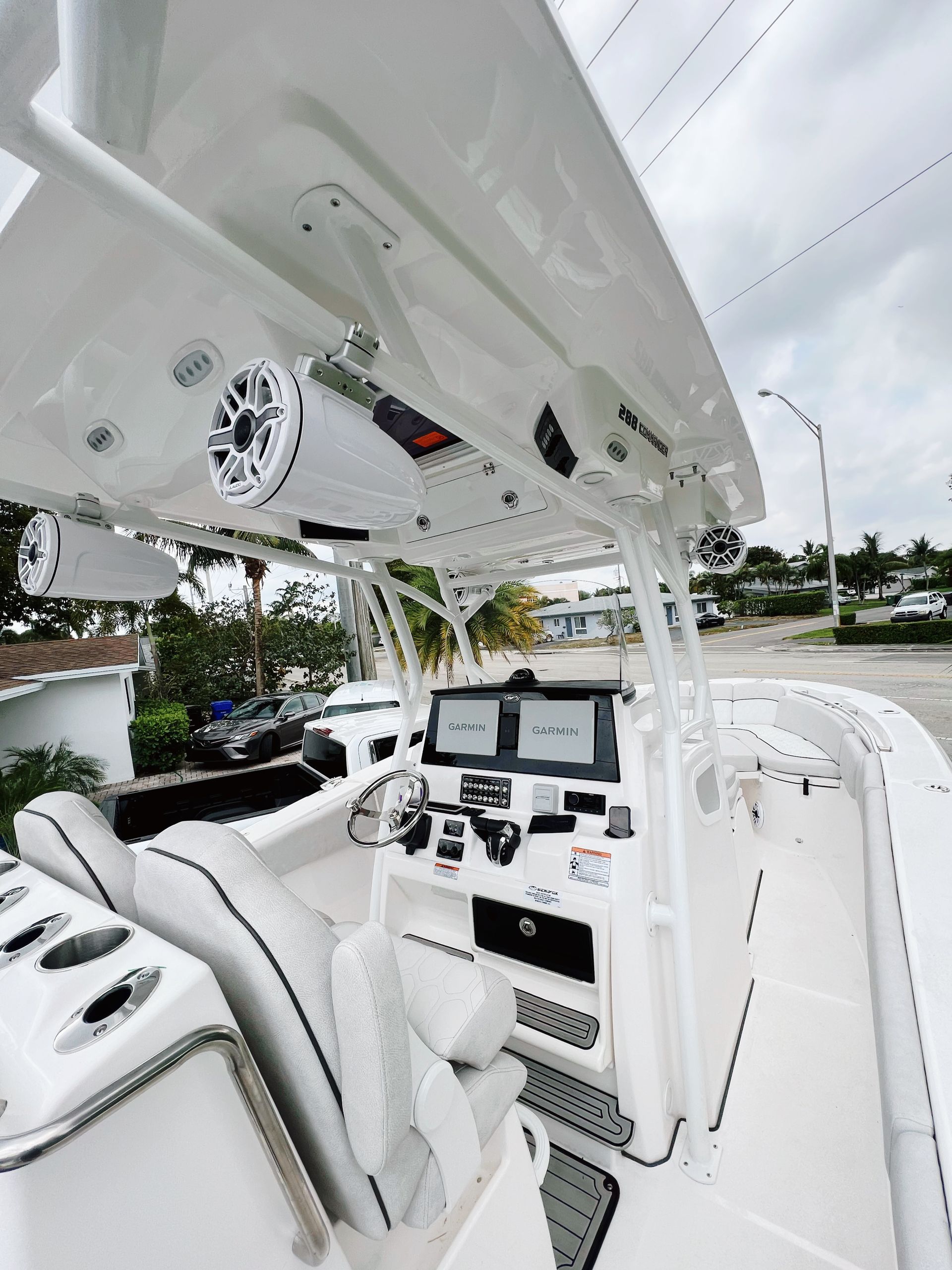
Step 3: Power On Your Chartplotter
Once you've installed your chartplotter, it's time to power it on.
Depending on your model, this may involve pressing a button or flipping a switch.
Once your chartplotter is powered on, it will guide you through the setup process, which may include selecting your language, setting your time zone, and selecting your preferred units of measurement.
Step 4: Plan Your Route
Once you've selected the "Navigation" option, the machine I'll show you a few different settings to customize your route.
One of the most important settings to consider is the type of route you want to take.
Your chartplotter can calculate the quickest, safest, or most fuel-efficient route, depending on your preferences.
You can also set your boat's speed and draft and the type of navigation aids you'd like to include in your route, such as buoys or landmarks.
Once you've entered all your settings, your chartplotter will calculate the route and display it on the screen.
You can then view the route differently, such as a list of waypoints or a visual representation on the chart.
The chartplotter will also provide additional information, such as the distance to each waypoint, the estimated time of arrival at your destination, and any potential hazards or obstructions along the way.
If you need to adjust your route, such as adding a new waypoint or avoiding an obstacle, you can do so easily using the chartplotter's drag-and-drop interface.
First, tap on the waypoint you want to adjust and drag it to a new location on the chart.
You can also delete waypoints or add new ones by selecting them from the chart or entering them manually.
One of the most important things to remember when planning your route is prioritizing safety.
Your chartplotter will provide information about potential hazards or obstructions along the way.
Still, it's up to you to use your judgment and make informed decisions about the safest route.
It's also important to know about weather or tide conditions affecting your journey and adjust your path accordingly.
Integrating Other Equipment on Board
Integrating other equipment on board your vessel is vital in getting the most out of your Garmin chartplotter.
With network connectivity and compatibility with other Garmin devices, you can easily display and monitor important data on your chartplotter's screen, improving your situational awareness and overall boating experience.
The radar is one of the most well-known pieces of equipment to integrate with your chartplotter.
Connecting a Garmin radar to your chartplotter lets you view real time radar images on the chartplotter's screen.
This can be incredibly useful for navigating in low visibility conditions, such as fog or heavy rain, and identifying potential hazards, such as other boats or obstacles.
Another vital equipment to integrate with your chartplotter is your boat's engines.
Many Garmin chartplotters are compatible with the Garmin Marine Network, which allows you to connect your engines and monitor vital data such as fuel consumption, engine performance, and more.
This can help you optimize your boat's performance, reduce fuel costs, and alert you to potential issues before they become more serious.
Beyond radar and engine monitoring, many Garmin chartplotters are compatible with a wide range of equipment on board your vessel, including lights, autopilots, fishfinders, and more.
By integrating these devices into your chartplotter's network, you can create a comprehensive and streamlined boating experience with all the information you need at your fingertips.
Finally, many Garmin chartplotters are compatible with the ActiveCaptain app, which allows you to manage your marine experience from nearly anywhere.
The app lets you download the latest charts and updates, plan routes, and remotely control your chartplotter.
This can be incredibly useful for planning your boating trips and adjusting on the fly while on the water.
Using GPS to Show Your Exact Location
One of the main features of a chartplotter is its ability to show your exact location on a nautical chart.
This is made possible through the chartplotter's GPS functionality, which uses satellite signals to determine your location and display it on the chart.
To use the GPS functionality of your chartplotter, you will need to have a clear view of the sky to receive satellite signals.
Once you have a GPS fix, your chartplotter will display your location on the chart, along with other helpful information such as speed, heading, and distance to your destination.
Many Garmin chartplotters have built-in sonar capabilities, including advanced CHIRP traditional sonar and Garmin ClearVü and SideVü scanning sonar.
This allows you to see what's under the water around you, giving you a better idea of the depth and terrain below your vessel.
What is a chartplotter?
A chartplotter is a device boaters and sailors use to navigate and plan waterway routes.
It is an electronic chart display system (ECDIS) that uses digital charts, GPS, and other sensors to provide real-time information about a boat's position, speed, and direction.
The device displays the boat's position and movement on an electronic chart that shows the surrounding waterways, coastlines, landmarks, and other navigational data.
This information is displayed on a high-resolution screen in various lighting conditions.
This device has many benefits over traditional navigation methods, such as paper charts and compasses.
It provides accurate real-time data that helps boaters navigate safely and efficiently, even in poor visibility conditions.
It also allows boaters to plan routes and monitor progress during the voyage.
In addition to navigation, chartplotters can integrate with other onboard equipment, such as radar, sonar, and autopilots, to enhance the situational awareness of boaters.
Overall, chartplotters have become an essential tool for boaters, especially those who operate in unfamiliar waters.
The technology has come a long way over the years, with advanced features such as touchscreen displays, wireless connectivity, and 3D mapping, making it easier than ever for boaters to navigate safely and efficiently.
How does a chartplotter work?
A chartplotter is a device that uses GPS technology to display the user's position on a nautical chart.
The chartplotter receives signals from GPS satellites and calculates the user's position, speed, and direction of travel.
It then displays this information on a chart showing the user's location relative to shorelines, buoys, navigation aids, and other features.
To use a chartplotter, the user must first enter information about their vessel, such as its size, draft, and type of propulsion.
This information calculates safe routes and alerts the user of potential hazards, such as shallow water, rocks, or other obstructions.
The user can also input a destination, and the chartplotter will calculate the best route to get there.
In addition to displaying the user's position, a chartplotter can also display other important information, such as depth soundings, water temperature, and weather conditions.
Some chartplotters can also integrate with other onboard systems, such as radar, sonar, and autopilot.
A chartplotter works using electronic charts, digital versions of paper charts that have been converted into a format that can be displayed on a screen.
The chartplotter reads this information and overlays it with the user's position and other data, creating a real-time view of the user's surroundings.
The chartplotter's display is usually a touchscreen, allowing users to interact with the device and enter information easily.
What kind of charts can be used with a chartplotter?
Chartplotters can use various charts depending on the manufacturer and the specific model of the device. Some of the most common types of charts that you can use with chartplotters include:
- Electronic Navigational Charts (ENCs): These are digital versions of traditional paper charts that hydrographic offices worldwide produce. ENCs are the most accurate and up-to-date charts available, and they are constantly updated with the latest information about water depths, hazards, and other features.
- Raster Navigational Charts (RNCs): These are scanned versions of traditional paper charts converted to digital format. RNCs are less accurate and up-to-date than ENCs, but they can still be helpful in areas where ENCs are unavailable.
- Vector Charts: These are digital charts created by software programs and can be customized with various layers of information. Vector charts are often used in inland waterways and other areas where traditional charts are not available or detailed enough.
- Fishing Charts: These are specialized charts that are designed for anglers and provide detailed information about fish habitats, underwater structures, and other features that can be useful for fishing.
Overall, the type of chart that you use with your chartplotter will depend on the kind of boating you do and the specific features you need to navigate safely and efficiently.
How do I choose the right chartplotter for my vessel?
Choosing the right chartplotter for your vessel is an important decision that requires careful consideration. Here are some factors to keep in mind:
- Vessel Size: The size of your vessel is an important factor when choosing a chartplotter. Larger vessels may require a larger screen size to ensure the chart and other information are easily read. Additionally, a big ship may need a chartplotter with more advanced features, such as network connectivity and compatibility with other onboard equipment.
- Intended Use: Consider how you plan to use your vessel when selecting a chartplotter. If you plan to use your vessel for fishing, look for a chartplotter with features such as fish-finding capabilities and built-in sonar. If you plan to use your boat for cruising, consider a chartplotter with a larger screen size and more detailed charts.
- Budget: Chartplotters are available at various price points, so it's essential to determine your budget before purchasing. Remember that more expensive gadgets often come with more advanced features, but a basic chartplotter may be sufficient for your needs.
- Screen Size: The size of the chartplotter's screen is an important factor to consider. A larger screen will make viewing the chart and other information easier but may also be more expensive. Consider your vessel's available space and budget when selecting a screen size.
- Network Connectivity: Some chartplotters offer network connectivity, which allows you to connect other onboard equipment, such as radar, sonar, and autopilot systems. If you have other equipment on board to integrate with your chartplotter, look for a model with network connectivity.
- Compatibility: It's vital to ensure your device is compatible with other onboard equipment. Look for a chartplotter compatible with the radar, sonar, and other equipment you have on board.
- Charts: Consider the type of charts compatible with the chartplotter you're considering. Some chartplotters are only compatible with specific charts, such as NOAA raster or Navionics charts. Determine which charts you need and ensure that your chosen chartplotter is compatible.
- Brand Reputation: Consider the reputation of the brand you are purchasing from. A reputable brand will likely provide quality products and reliable customer service.
When choosing a chartplotter, consider vessel size, intended use, budget, screen size, network connectivity, compatibility, charts, and brand reputation.
By carefully considering these factors, you can select a chartplotter that meets your needs and enhances your boating experience.
Conclusion
Garmin chartplotters are essential for any boater who wants to navigate confidently.
Their intuitive interfaces, powerful features, and compatibility with other Garmin devices make it easy to plan routes, set courses, and monitor your surroundings while on the water.
Whether you're a serious angler, sailor, or cruiser, a Garmin chartplotter will meet your needs.
From the powerful GPSMAP x3 series to the versatile ECHOMAP Ultra and UHD2 series, Garmin has a chartplotter for every boater and every budget.
So if you're ready to take your boating experience to the next level, consider investing in a Garmin chartplotter.
Its advanced features, user-friendly interface, and reliable performance make it the ultimate navigation tool for any boater.
Contact Us
Contact Us
Recent Posts
CONTACT US
Looking to upgrade your marine electronics?
With more than 25 years of experience, we can help you get started today!